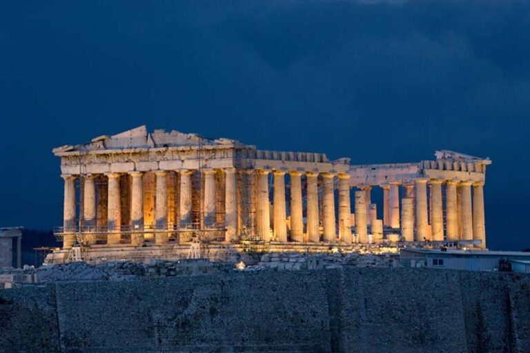
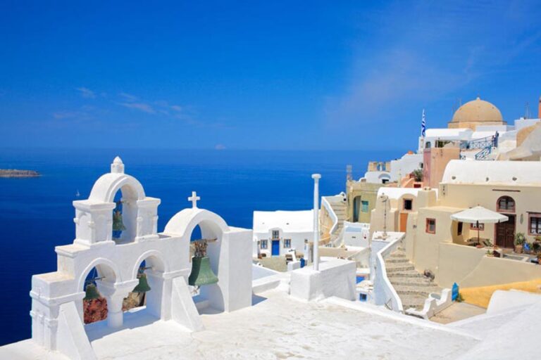
Plan your TURKEY holiday with our collection of personalized TURKEY tour packages. Travel to Turkey to explore the wonders of Turkey, historical monuments, and breathtaking landscapes. Choose from a variety of Turkey Tours to savour


Explore The Best Of Turkey With Customizable Tour Packages
the most memorable experience of your life on your Turkey Travel. Wide Range of Turkey Tours give you a chance loose yourself in the wonders of magnificent historical sites, royal cities, and captivating coastlines along the Mediterranean Sea.


OUR PROPOSALS
SPECIAL OFFER
'Turkey Tours'


ISTANBUL TOUR PACKAGES
Istanbul 8 Day Package Tour
ISTANBUL TOUR PACKAGES
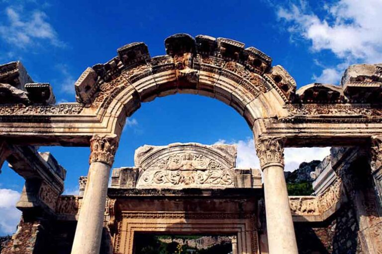
Discover the ancient cities of Anatolia on an 8-day tour of Turkey. Visit the ruins of Ephesus and Hierapolis.
DETAILS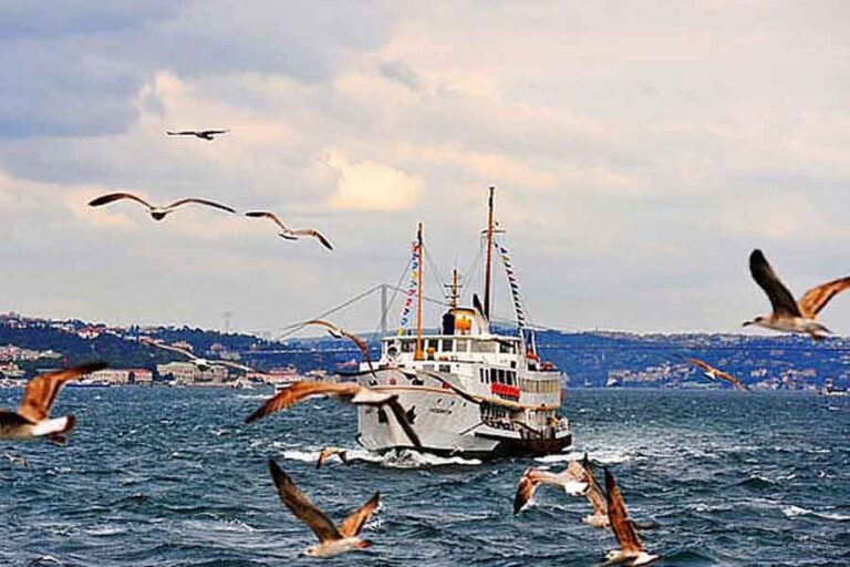
Istanbul 4 Day Mini Package Tour
ISTANBUL TOUR PACKAGES
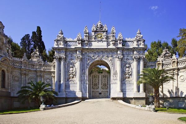
Enjoy a 4-day guided tour of Istanbul, visiting all the highlights, from the Topkapi Palace and Blue Mosque.
DETAILS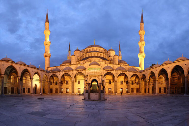
Istanbul 5 Days Tour Package
ISTANBUL TOUR PACKAGES
Istanbul city tours including the Blue Mosque, Hippodromme, Hagia Sophia, Topkapi Palace.
DETAILSTURKEY PACKAGES TOURS
15 Day Highlights of Turkey Tour Package
TURKEY TOUR PACKAGES
Memorable monuments, mosques and fairytale landscapes of Turkey on a 15-day.
DETAILS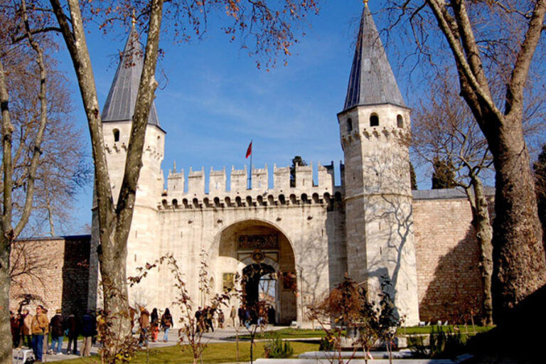
14 Days Turkey Tour (Glories of Turkey)
TURKEY TOUR PACKAGES
Explore the Byzantine and Ottoman monuments of Istanbul before traveling through the unique volcanic landscapes of Cappadocia. Relax on the beaches of the Turquoise Coast, and end with a trip to the ancient cities of Hierapolis and Ephesus.
DETAILS
14 Day Anatolia Tour from Istanbul
TURKEY TOUR PACKAGES
Enjoy a leisurely 15-day tour of Turkey, designed for the traveller who prefer to combine the major sites of Anatolia.
DETAILSTURKEY BUDGET TOURS

Turkey Budget Tour by Bus – Istanbul, Cappadocia, Pamukkale, Ephesus, Selcuk, Istanbul
TURKEY BUDGET TOUR PACKAGES
Discover Cradle of Turkey’s Civilizations on a 7-day tour on budget from Istanbul.
DETAILS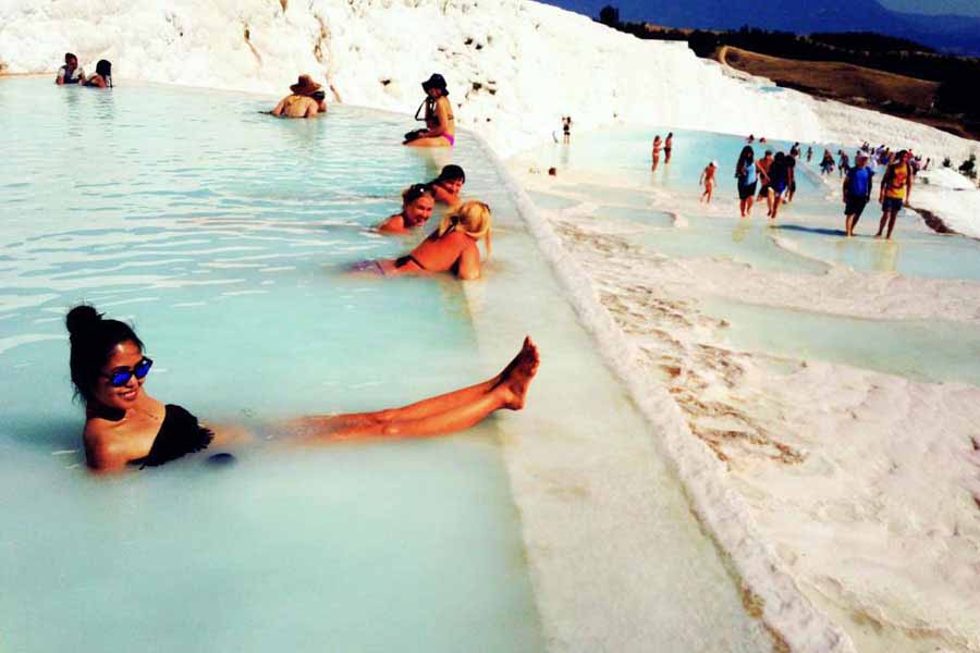
Turkey Budget Tour 2 by Bus 15 Days
TURKEY BUDGET TOUR PACKAGES
This travel package is ideal for the first time visitor to Turkey. Includes guided day tours.
DETAILS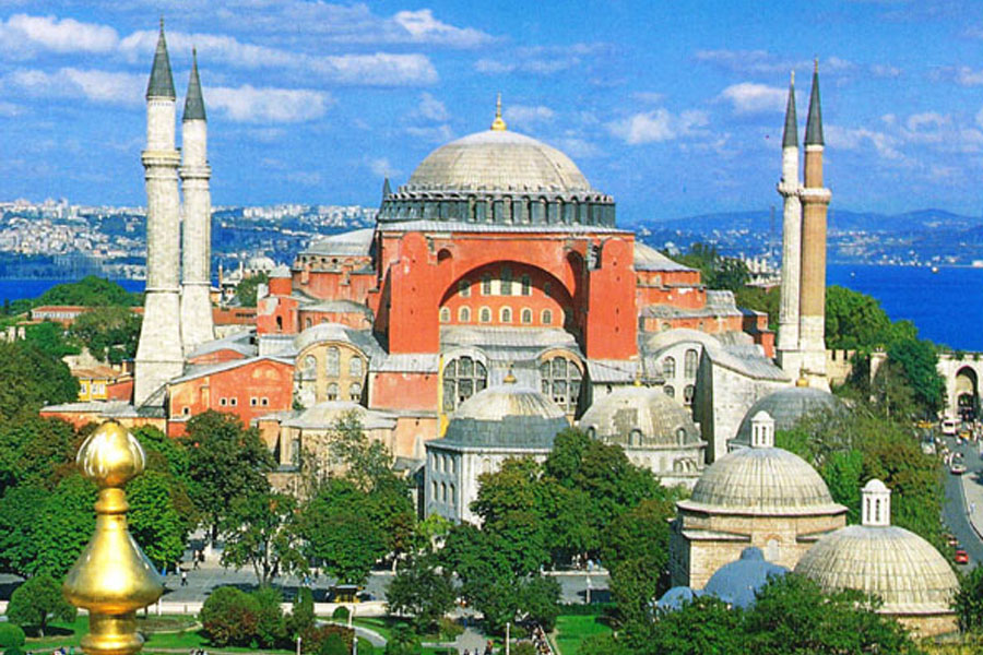
Turkey Budget Tour – 7 Day Turkey Highlights Tour
TURKEY BUDGET TOUR PACKAGES
Led by a professional guide, travel by bus, and foot, and delve deep into a history.
DETAILSCAPPADOCIA TOURS

4 Days Cappadocia, Pamukkale and Ephesus Tour by Plane (from Istanbul)
CAPPADOCIA TOURS
Delve deep into a landscape of rich history and ancient wonders led by a professional guide. Visit Ephesus, see the Fairy Chimneys of Cappadocia, visit the Temple of Artemis, and witness the rock formations at Pamukkale.
DETAILS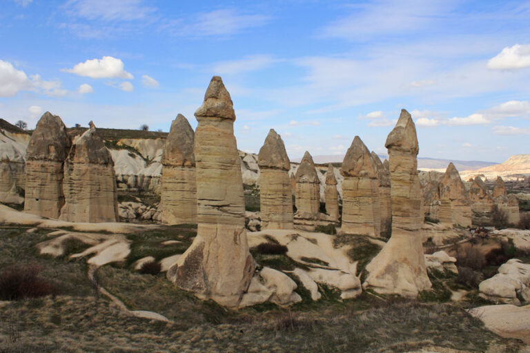
4 Days Cappadocia, Pamukkale and Ephesus Tour by Bus (from Istanbul)
CAPPADOCIA TOURS
Delve deep into a landscape of rich history and ancient wonders led by a professional guide. Visit Ephesus, see the Fairy Chimneys of Cappadocia, visit the Temple of Artemis, and witness the rock formations at Pamukkale.
DETAILS
3 Days Cappadocia Pamukkale Tour Package From Istanbul by Plane
CAPPADOCIA TOURS
See the Fairy Chimneys of Cappadocia, a very unique nature and witness the rock formations at Pamukkale.
DETAILSDREAM TOURS
Discover Cappadocia
BOSPHORUS SUNSET
Sunset Cruises on Luxury Yacht
EPHESUS TOURS
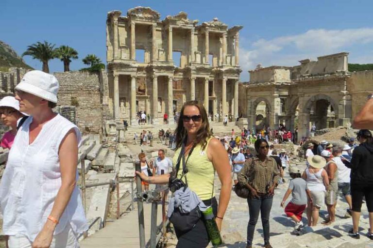
Explore Ancient Ephesus: Full-Day Tour From Istanbul
EPHESUS TOURS
Explore the fascinating city of Ephesus on a full-day tour, arriving from Istanbul by overnight bus. Visit the beautiful Library of Celsius, explore the famed Virgin Mary House, and admire the Temple of Artemis, one of the Seven Wonders of the World.
DETAILS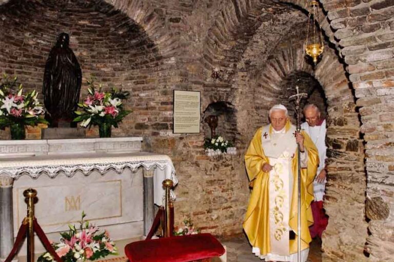
Day Tour of Ephesus, House of Virgin Mary and Artemis Temple
EPHESUS TOURS
Join a full-day guided tour from Kusadasi and explore the remarkable ruins of the ancient city of Ephesus. Visit the last documented residence of the Virgin Mary, and see the remains of the Temple of Artemis.
DETAILS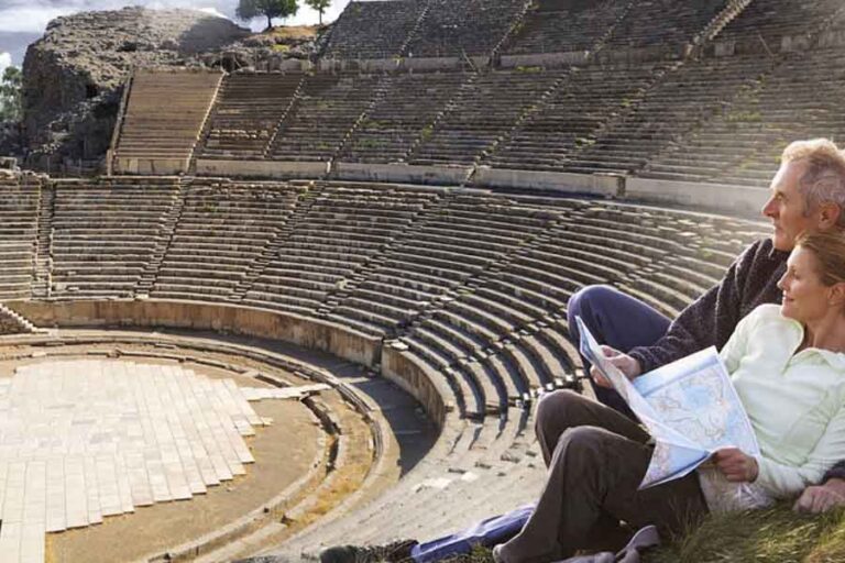
3 Days Ephesus and Pamukkale Tour by Bus from Istanbul
EPHESUS TOURS
Seeing the ancient city of Ephesus, the Temple of Artemis, the house of Virgin Mary.
DETAILS
Welcome
to Turkey
ALL IN ONE DAY ISTANBUL
HISTORICAL TOUR OF ISTANBUL WITH BOSPHORUS SUNSET CRUISE
Combine a trip to both Istanbul’s greatest sites including the Blue Mosque, Hagia Sophia, Topkapi Palace, Grand Bazaar and a luxury yacht cruise on the Bosphorus in one day. Take advantage of special no-wait entry at the Topkapi Palace and skip-the-line access to the great Ottoman Palace during this full-day tour.


160 120 € / FOR PERSON
TURKEY TOUR PACKAGES AND DEALS SEARCH
KEEP IN TOUCH
Travel with Us
Turkey Golden Tours maintains English speaking and multilingual staffs in major destinations throughout Turkey and Greece ready to help you in every minutes until your departure back home. Because to make your vacation unforgettable and dreamlike without trouble is our business. For more information, please contact us by e-mail.